INFORMATION ON HALONG BAY
HALONG BAY AND BAI TU LONG BAY
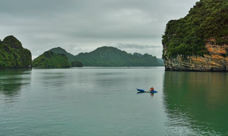
Classified by Unesco as a World Heritage Site in 1994 and as one of the Natural Wonders of the World in 2011, Halong Bay is one of the most famous sites on Earth. Stretching on around 1500 km² 120 km northeast of Hanoi, it counts nearly 2000 limestone isles and islets of all shapes and sizes rising from the sea.
Geologists think that the region was in the high sea during the Primary Era (between 543 and 250 million years ago). Movements of the Earth crust changed it into a high plateau submitted to intense erosion leaving only the harder rocks, which were then eroded into a myriad of islets dotted with grottoes, holes and tunnels.
Its Vietnamese name Ha Long means « Descent of the Dragon ». According to the legend, a dragon run towards the sea to tame the currents and the violent movements of its tail carved the highland; when it plunged into the sea, its level raised and filled the area with water, leaving only the highest formations.
What is commonly called « Halong Bay » consists in fact into 3 bays. Form South to North:
The small Lan Ha Bay, south of Cat Ba Island, inaccessible to large boats, thus more intimate;
Halong Bay north of Cat Ba Island;
Bai Tu Long Bay, north of Halong Bay and very different: further North, it is less frequented by tourists; its ecosystems (rain forest and marine) are richer, and, above all, the bay counts several large islands with beaches and hotels (Islands of Quan Lan, Co To, Ngoc Vung, etc.)
CAT BA ISLAND AND LAN HA BAY
The Archipelago of Cat Ba, located 50 km east of the harbour of Haiphong (1 hour by speed boat) counts 366 limestone islands and islets. With an area of 285 km², Cat Ba Island itself is the largest and most populated of the region. Its capital, Cat Ba City, counts around 20 000 inhabitants, the majority in the town and about 5 000 living in floating villages. Economic center of the area, the town counts many hotels, especially on the seafront Esplanade. Cliffs tower over most of the coastline, except for a few beaches and small fishing villages sheltered in coves.
Cat Ba National Park covers three-quarters of the island; this 14 000-ha natural reserve of mountains and remains of tropical forest is a walking and trekking center. The small harbour of Cai Be is the departure point of many cruise junks. South of the island, Lan Ha Bay, not accessible to large boats, is a superb illustration of the entire maritime region.
NGOC VUNG ISLAND
Ngoc Vung Island is in the shape of crescent and has an area of around 40 square kilometers. On the island is Van Xuan Mountain with the height of 182 meters and a 2-kilometer beach with pure white sand. Ngoc Vung Beach is one of the most beautiful beaches on Halong Bay. The local residents on Ngoc Vung Island live on fishing and pearl farming. Therefore, there are many fishing boats and floating pearl farms near the island.
On Ngoc Vung Island, tourists will have chance to enter the enchanted world of mountain and beach; enjoy quiet and peaceful atmosphere there. Moreover, tourists can relish delicious dishes made from fresh sea products provided by local fishermen. The best way to explore Ngoc Vung Island is by cycling on small roads around the Island.
OUR JUNK ORIETAL SUN DO THE 4 DAYS TRIP TO NGOC VUNG ISLANS WITH 2 NIGHTS ON THE BUNGALOW IN FRONT OF THE BEACH.
TUAN CHAU ISLAND
Tuan Chau Island has the original size of 2.5 square kilometers and it now covers an area of 4 square kilometers. On the island, the weather is cool all around the year. It’s featured with 2-square kilometer green pine forest, white sand beach stretching 6 kilometers. These all features make Tuan Chau Island an ideal place for visiting and relaxing on Halong Bay.
OUR JUNK CAN PICK UP AND SEND OFF AT TUAN CHAU ISLAND BY A TENDER OF MILITARY DURING 10 MINUTES.
.jpg)


